
PNNL publishes interactive data center map
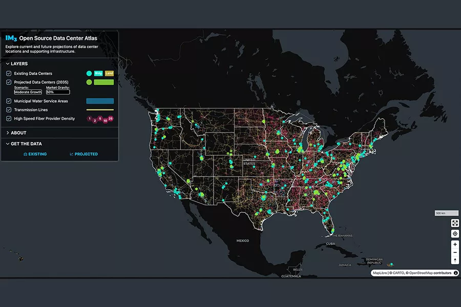
A screenshot of the dashboard interface with all supporting infrastructure layers showing.
Courtesy of Kendall Mongird | Pacific Northwest National LaboratoryA new map of data centers and related infrastructure across the U.S. developed at Pacific Northwest National Laboratory is being touted as a way to help utilities and communities anticipate and prepare for the potential impacts of the resource-hungry facilities.
The Data Center Atlas, part of the Integrated Multisector, Multiscale Modeling project at the lab, is a public tool built from numerous data sources, some of them previously proprietary, of data center locations. It also includes projections on where future facilities may be constructed.
And it’s more than a tool to be looked at: all the map’s data can be downloaded and is open source, ensuring it can be fully used for planning everything from energy infrastructure to water supplies.
“The research team hopes the Atlas will support more collaborative, transparent infrastructure planning efforts as data center development accelerates,” PNNL said in a statement. “By making the tool open and accessible, the creators hope it can support informed conversations about tradeoffs, co-benefits, and long-term planning for data centers from local to national scales.”