
Smoky skies this weekend? New WSU tool has your forecast
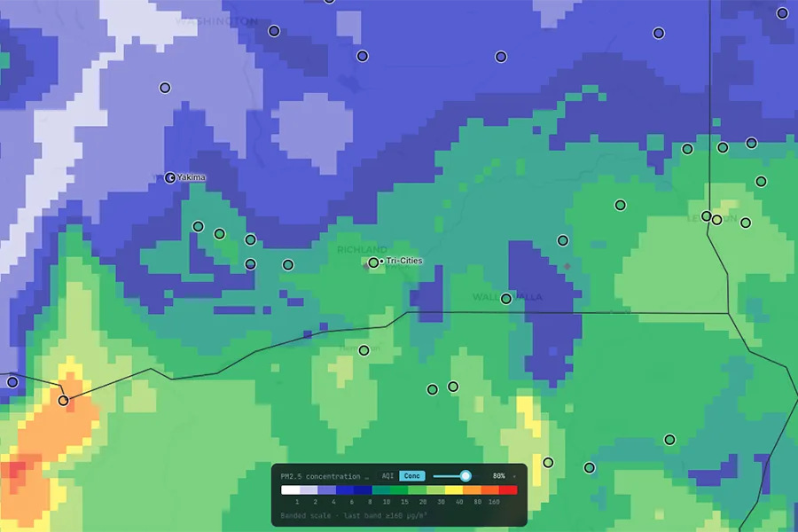
A new WSU interactive map provides information on fine particulate matter and ozone concentrations, as well as fire locations and intensity, smoke layers, meteorological conditions and other data for Washington, Oregon and Idaho, along with parts of surrounding states.
Courtesy WSUPlanning outdoor activities this weekend? Before you head out, a new interactive map from Washington State University can tell you whether smoky skies will be a problem.
The tool provides 72-hour, close-to-home air-quality forecasts across Washington, Oregon, Idaho and parts of surrounding states. To check your forecast, put your zip code in the “Find a place” section and click the play button on the map. The map offers a three-day rolling forecast.
“Think of it like a weather forecast, but for the air we breathe,” said Jun Meng, an assistant professor in the Department of Civil and Environmental Engineering in the Voiland College of Engineering and Architecture, in a statement. “When we plan for the weekend or other events, we always check the weather. But with the intensifying wildfire situation, people are becoming more aware of the air quality and the need for this kind of forecast.”
The map tracks fine particulate matter, ozone, fire locations and smoke layers down to a 4-kilometer grid square. Meng and his Air Quality Research Lab developed the update, funded by the NW-AIRQUEST Consortium, which is made up of agencies and universities in a three-state region.
The improved map is among a series of updates to the Air Indicator Report for Public Awareness and Community Tracking, or AIRPACT6, a project that provides information and guidance to meteorologists, officials making decisions about burn bans or health advisories, and the public.
“It’s literally an evolving science project,” Meng said. “We are collaborating with state and local agencies, and we are providing something that we can validate. We evaluate over a season, and the next season we'll update what we have missed.”